ATTAIN Central Florida
|
|
| Advanced Transportation Technology |
The Florida Department of Transportation (FDOT) District 5 has received an Advanced Transportation and Congestion Management Technologies Deployment (ATCMTD) grant from the Federal Highway Administration (FHWA) to improve reliability, reduce congestion and increase mobility and safety on roads throughout Central Florida. FDOT’s grant program, titled ATTAIN Central Florida, will deploy smart transportation technologies on roads nearby and inside the main campus of the University of Central Florida (UCF) in Orlando and in other locations throughout Central Florida. Best practices and lessons learned from successful deployments will be transferred and applied to future deployments throughout the District’s nine counties.
Partners
Florida Department of
Transportation (FDOT) District 5
FDOT is the grant applicant that manages all programs, oversees funding and is responsible for all deliverables. FDOT also leads collaboration and cooperation between counties, municipalities and other transportation agencies.
MetroPlan Orlando
Planning organization for Orange, Seminole and Osceola counties that will facilitate collaboration among county and municipal agencies, and also ensure that all projects meet their intended purposes.
University of Central Florida (UCF)
UCF is providing data collection and analysis expertise, research capabilities and deployment locations for multiple projects at its main campus.
Local Agencies
In Central Florida, 28 local governments and regional agencies have approved resolutions in support of the ATTAIN Central Florida grant.
| Programs |
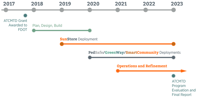
FDOT will implement three interrelated programs — PedSafe, GreenWay, SmartCommunity — over five years that will connect through its SunStore data storage initiative.
![]()
This is an innovative pedestrian and bicycle collision avoidance system that utilizes connected vehicle technologies to reduce the occurrence of vehicular collisions with pedestrians and bicycles at high crash locations.
![]()
This program will deploy several advanced traffic management technologies aimed at reducing congestion and increasing mobility throughout the region.
![]()
This is program focuses on new technologies that connect people with places they want to go and services they need.This program focuses on new technologies that connect people with places they want to go and services they need.
![]()
This initiative stores multiple data sources from the region's transportation systems management and operations to be made available for research purposes.
| Funding |
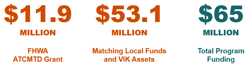
The ATTAIN Central Florida program also will provide a significant capital investment in Central Florida by combining an $11.9 million ATCMTD grant from FHWA with non-federal funds or in-kind assets totaling $53 million.
 |
| Economic Benefits |
The program will produce economic benefits by improving safety, enhancing system performance and throughput, reducing delays and providing efficient and reliable movement of people, goods and services throughout the region. Commuters in Orlando spend an average of 57 hours a year in traffic, costing the region more than $1.1 billion in economic impact, according to the 2019 Urban Mobility Report published by the Texas A&M Transportation Institute. Imagine the benefit local businesses have to gain if motorists spent less time in traffic and more time in shops, hotels, restaurants and more.
| Timeline |
PedSafe
Pedestrian and Bicycle Collision Avoidance System
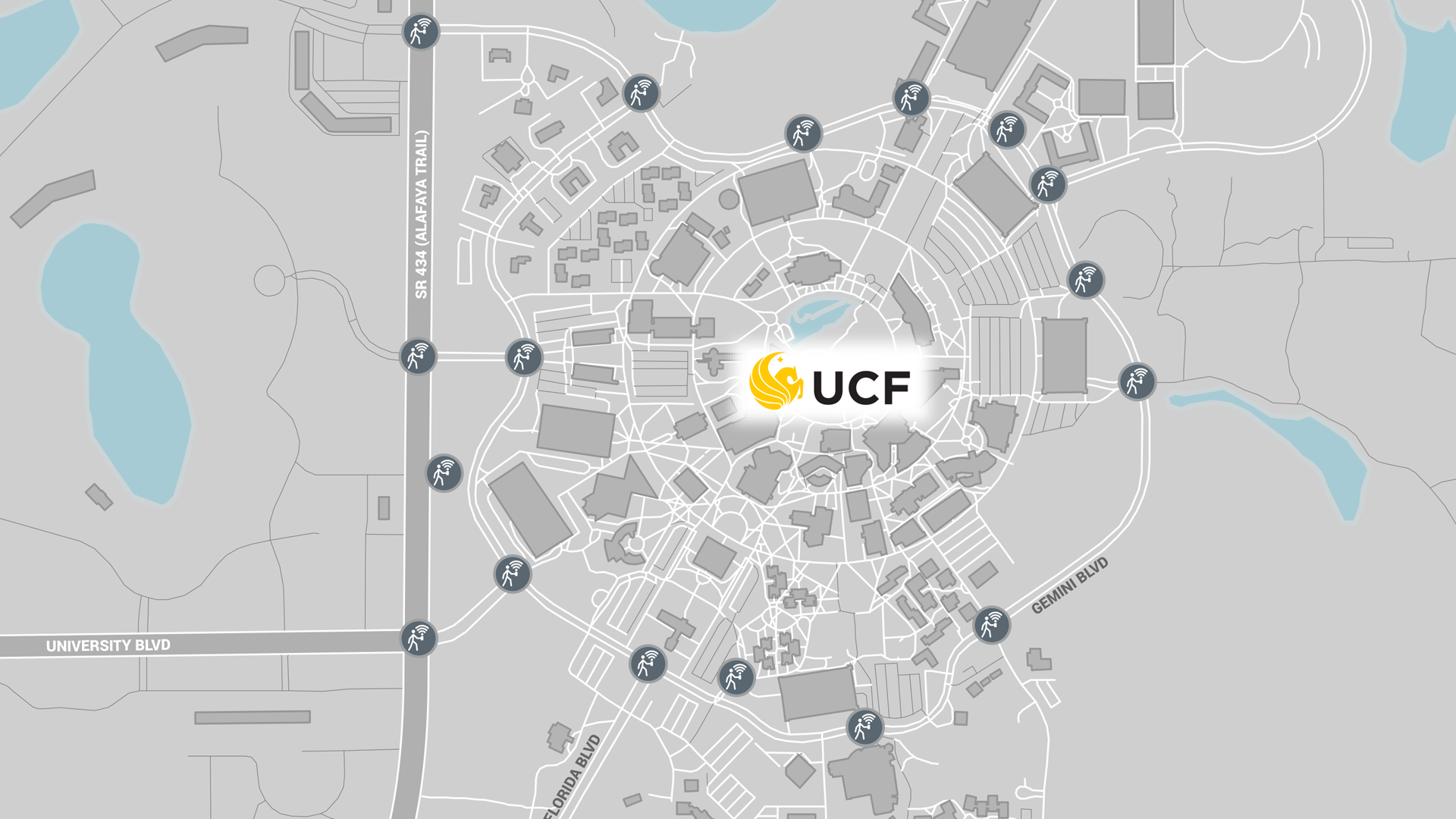
Pedestrian Safety (PedSafe) is an innovative pedestrian and bicycle collision avoidance system that will utilize connected vehicle technologies to reduce the occurrence of vehicular collisions with walkers and cyclists in crosswalks at high crash locations. Connections to existing traffic signal systems will provide information on when traffic lights change along with pedestrian detection to reduce conflicts with vehicles. PedSafe will be implemented on the UCF main campus, on Alafaya Trail (State Road 434), McCulloch Road and on Colonial Drive (U.S. Highway 50) near the Pine Hills Neighborhood.
GreenWay
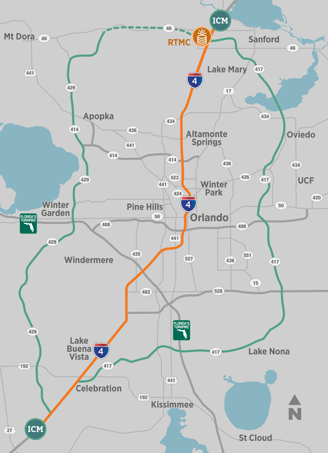
Integrated Corridor Management
Integrated Corridor Management (ICM) is a program designed to keep drivers moving and not sitting idle when an incident blocks all traffic lanes on Interstate 4 (I-4) in Orlando. Within six minutes, ICM can analyze an incident, predict traffic behavior up to 30 minutes into the future and provide the most efficient alternate route plan to steer traffic off I-4, around the incident and back onto I-4. This information is shared with local agencies to manage traffic light phases and allow for the constant flow of redirected traffic. The following components make ICM a dynamic system.
Regional Integrated Corridor Management Software (R-ICMS)
This is the heart of the ICM program that stores and manages all of the roadways and rail transportation for the region. Without this software, transportation agencies would not be able to collect data on how to reroute traffic when necessary.
ICM Predictive Model
Imagine yourself having the ability to look 30 minutes into the future to figure out a better route of travel based on the predicted level of traffic on a roadway. As the brain of the ICM system, this model predicts the best route of travel prior to implementing a diversion route response plan. It also can suggest whether or not a diversion route will be beneficial and when a diversion route is no longer necessary.
ICM Model Software
This helps the predictive model make accurate estimates based on real time data by analyzing traffic flow and speed volume, and then using this information to calculate different detour routes.
ICM Resonse Plan
ICM is mostly an automated procedure. But when it comes to approving the plans the software has created to steer traffic around a road conflict, that’s when it becomes manual. The ICM Response Plan takes all of the collected data, creates various suggested strategies and sends the information to a corridor manager for approval. That manager sends approved plans to appropriate transportation agencies in their respective jurisdictions to execute signal timing or makes changes to dynamic message signs.
Connected Vehicle Infrastructure
Connected vehicle (CV) infrastructure technologies will transmit warnings and caution messages to vehicles with onboard units (OBU) installed and to OBU emulators in smart phones with the UCF Mobile app installed. The warnings and caution messages include Signal Phase and Timing (SPAT), Transit Signal Priority (TSP), Emergency Vehicle Preemption (EVP), right turn in front of transit vehicle, curve speed warning and pedestrian in signalized Intersection. The CV infrastructure technologies will initially be used by UCF transit vehicles and first responder vehicles, and also be an important component in FDOT’s PedSafe pedestrian and bicycle collision avoidance system.
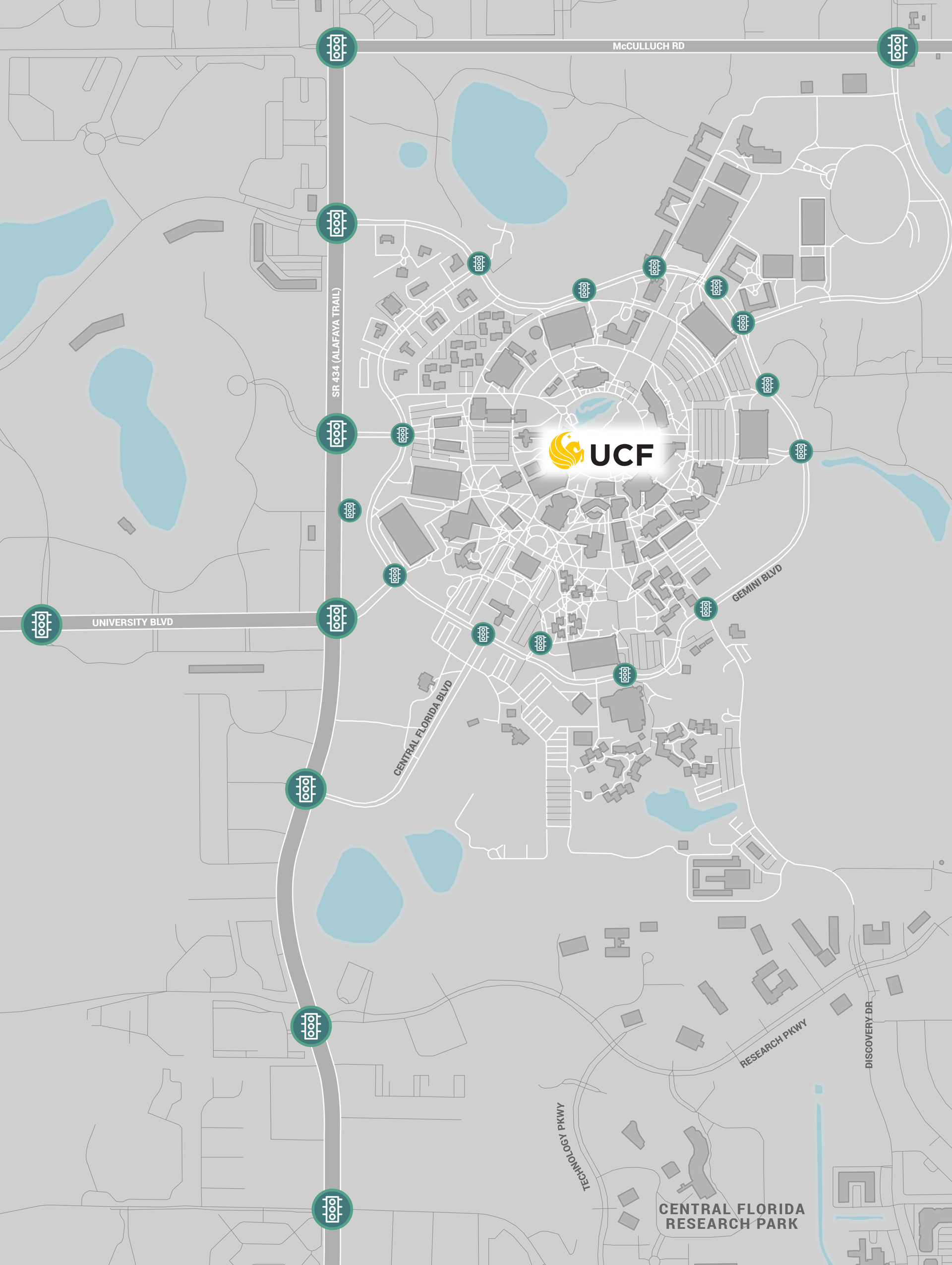
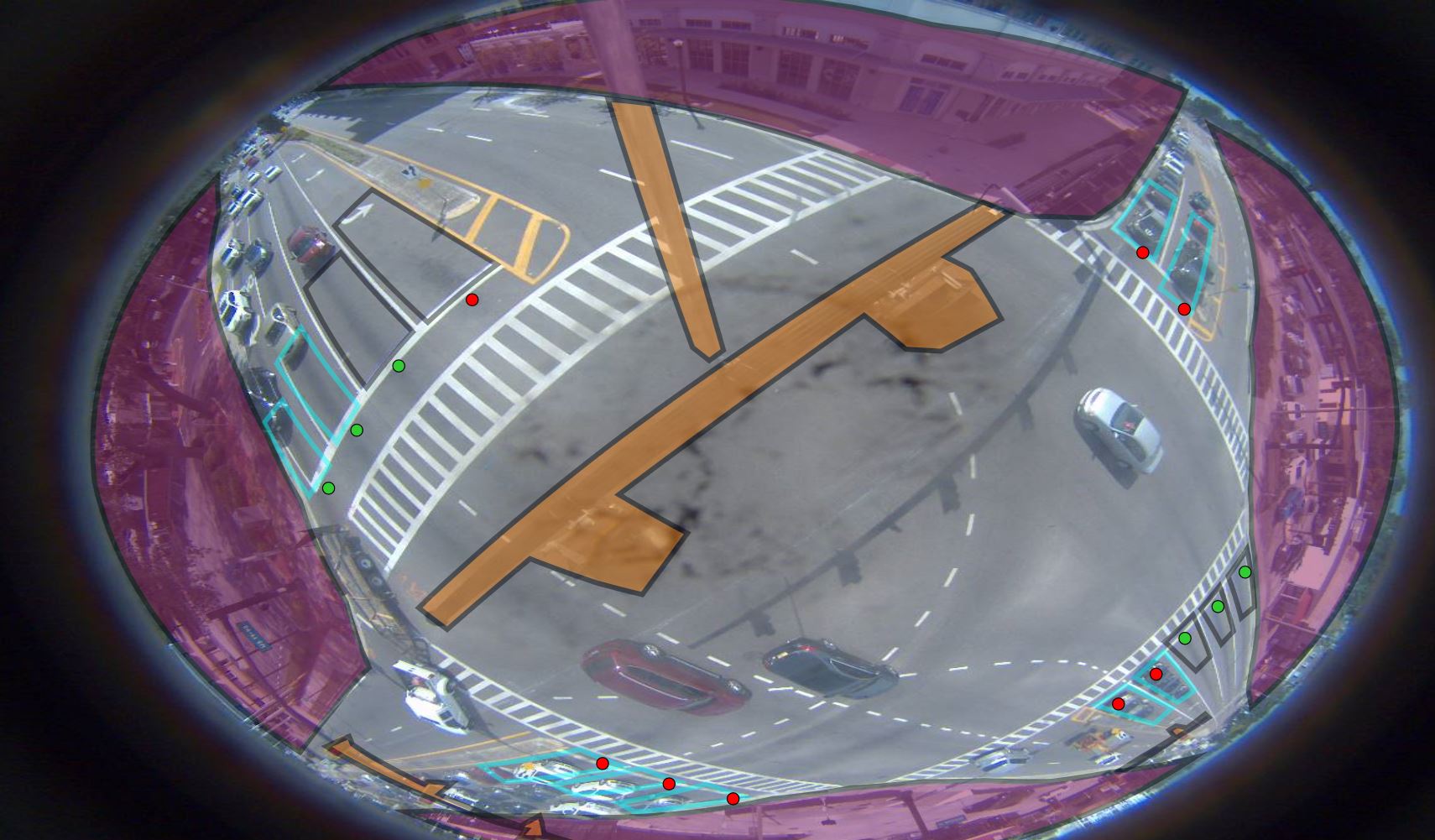
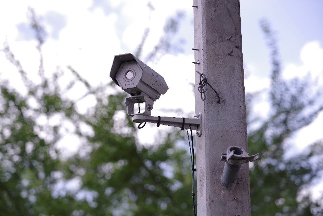
Intersection Movement Counts
This technology will allow intersection movement count (IMC) data to be collected for adjusting traffic signal timing in real-time instead of manually once every three years. This will optimize traffic flow at intersections and improve safety for road users, and also result in fewer stops, reduced travel times, increased average speed, reduced fuel consumption and emissions, fewer accidents and reductions in side street delays. FDOT is installing IMC hardware and firmware in 250 intersections located in Orange, Osceola, Seminole and Brevard counties. IMC data will be saved in SunStore.
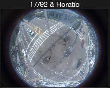
The following images from the intersection of U.S. 17/92 and Horatio in Seminole County show a camera view of this interaction before and after the IMC software configures and masks zones that provide IMC data to FDOT.
Automated Traffic Signal Performance Measures
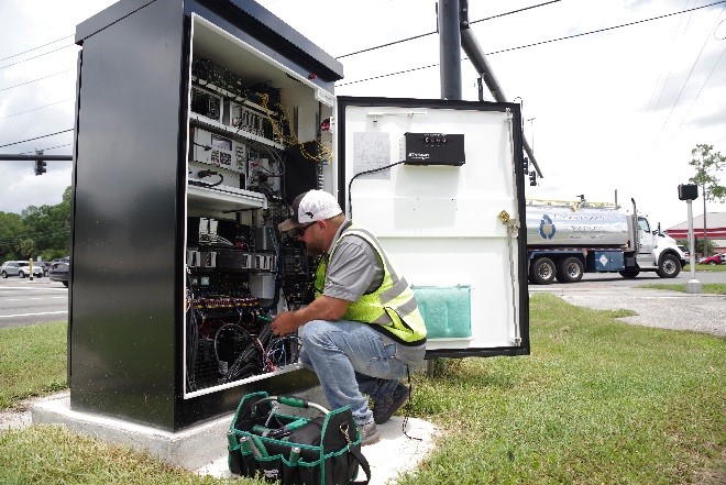
FDOT is updating traffic signal controllers, cabinets and controller firmware at 1,000 intersections to support high-resolution data logging to provide Automated Traffic Signal Performance Measures (ATSPM) for real-time monitoring of system health and quality of operations. ATSPM is one of more than 50 innovative traffic management technologies promoted by FHWA’s Every Day Counts initiative to ensure that roads and infrastructure are built better, smarter and safer.
Transit Signal Priority
As a LYNX bus approaches an intersection, it can communicate its intent to the traffic signal interface. Traffic signals then adapt to this information in real-time to create traffic priority control, which shortens a red light or holds a green light to help keep transit vehicles on schedule or catch up if behind schedule. This gives vehicles clearer and safer paths to their travel destinations. In an important upgrade that replaces older infrared technology, transit signal priority technology is able to manage critical left turns, which have historically been some of the most difficult to navigate for public transit vehicles. Additional benefits at intersections include fewer stops, increased average speed, reduced fuel consumption and emissions, fewer accidents and reduced travel times.
Adaptive Traffic Signal Interface with Positive Train Control
This traffic management technology interface is located at intersections near railroad crossings, where it identifies incoming trains a set amount of minutes ahead of their arrival. This technology receives and reacts to these advance train arrival notifications through integrations with FDOT traffic management systems and the SunRail advanced vehicle locating system. Through these communications, the most ideal traffic light signal movements are initiated for positive train control by shortening red lights or holding green lights. This reduces congestion and prevents dangerous driving behaviors at railroad crossings and nearby intersections.
SmartCommunity
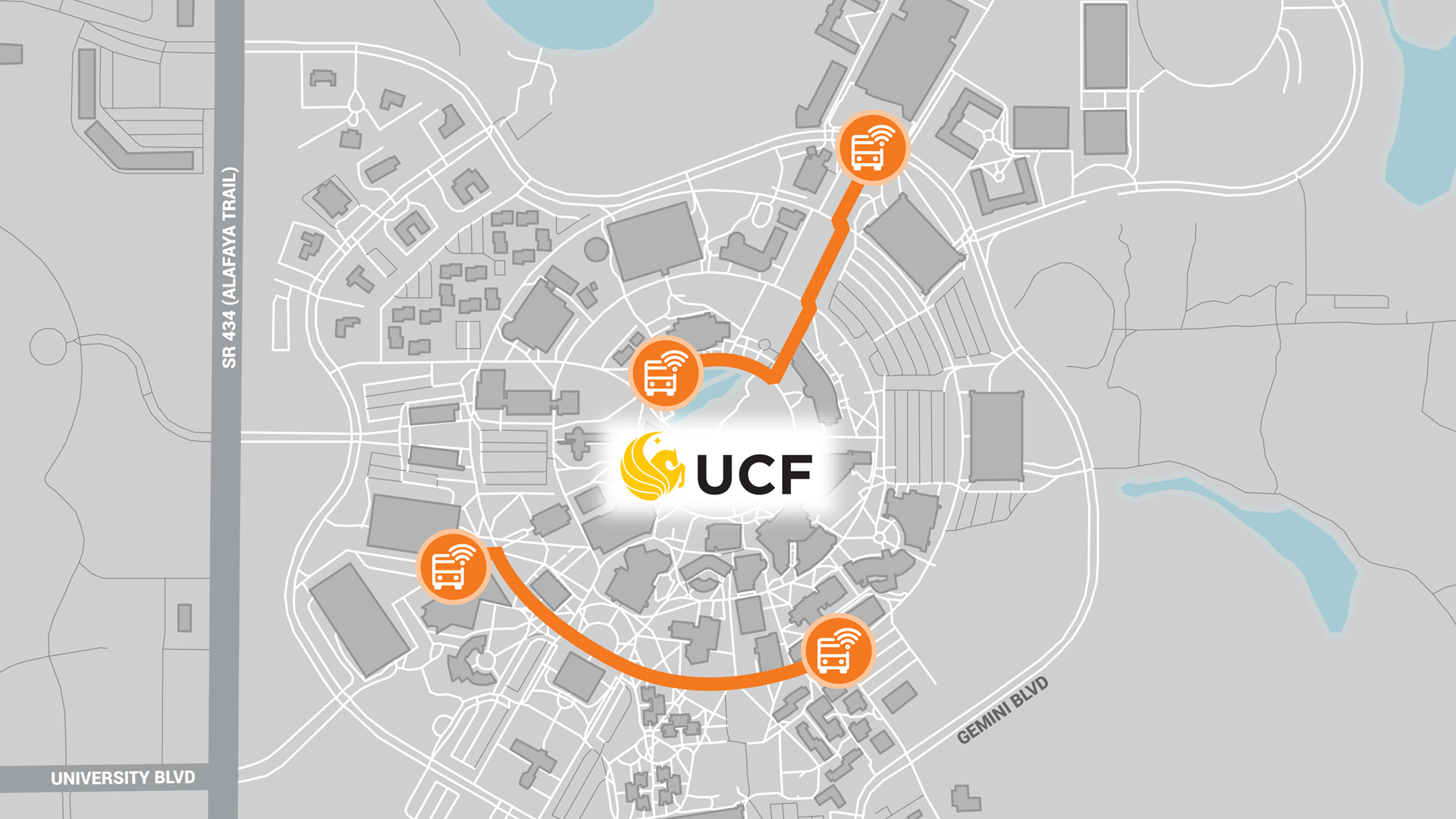
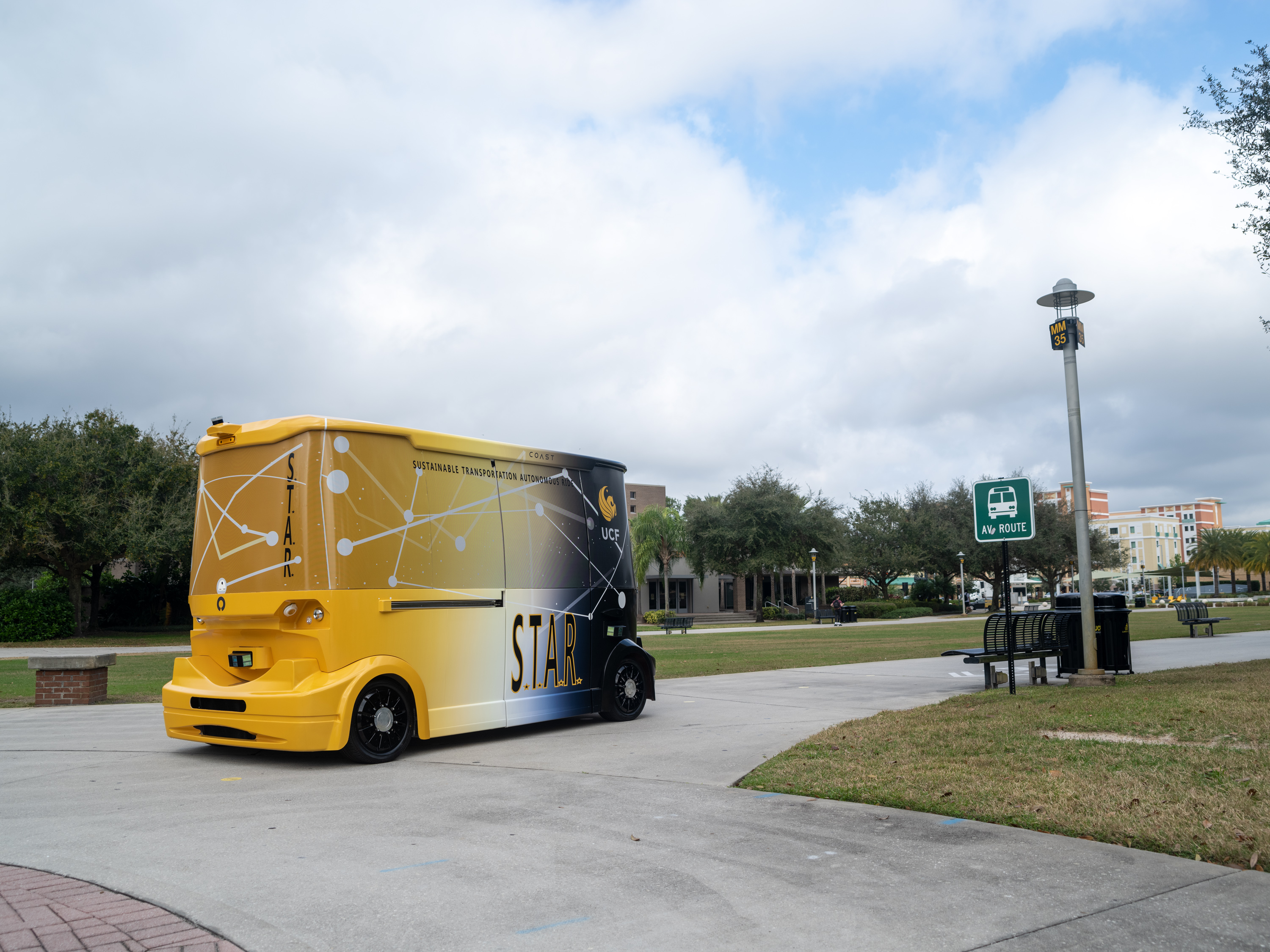
Autonomous Vehicle (AV) Shuttle
A pair of driverless, electric autonomous vehicle (AV) shuttles will begin operations on the main campus of the University of Central Florida (UCF) in fall 2021. The AV shuttle service will be provided for three years. The operations on the main campus shuttles will transport students, faculty, staff and visitors at a maximum speed of 15 mph along two routes on sidewalks that are closed to regular vehicle traffic. Both routes will extend from outer areas of campus where parking, residences and recreation facilities are located to the center of campus where academic and administrative buildings, the university student union and main campus library are located. The shuttles will be COAST P-1 models manufactured in St. Petersburg, Fla. by COAST Autonomous, a self-driving mobility company headquartered in Pasadena, Calif. The COAST P-1 AV shuttle also will offer real time vehicle data which FDOT will capture and save in its SunStore system, and also make available for research purposes.
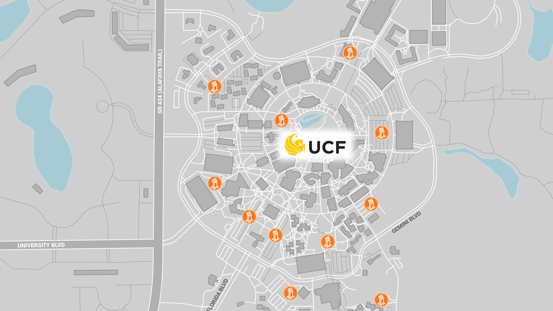
Transit Kiosks
Transit kiosks will be installed at existing shuttle stop locations on the University of Central Florida main campus to provide users with the ability to combine multiple modes of transit for a single trip to a destination. Users will be able to input origin-destination information to determine the most cost-effective and efficient combination of transport modes for travel. These kiosks can coordinate trip planning to employment centers, education facilities, the grocery store and medical treatment centers, and also provide mobility on demand to underserved users in the region who don’t own cars or have access to smartphones.
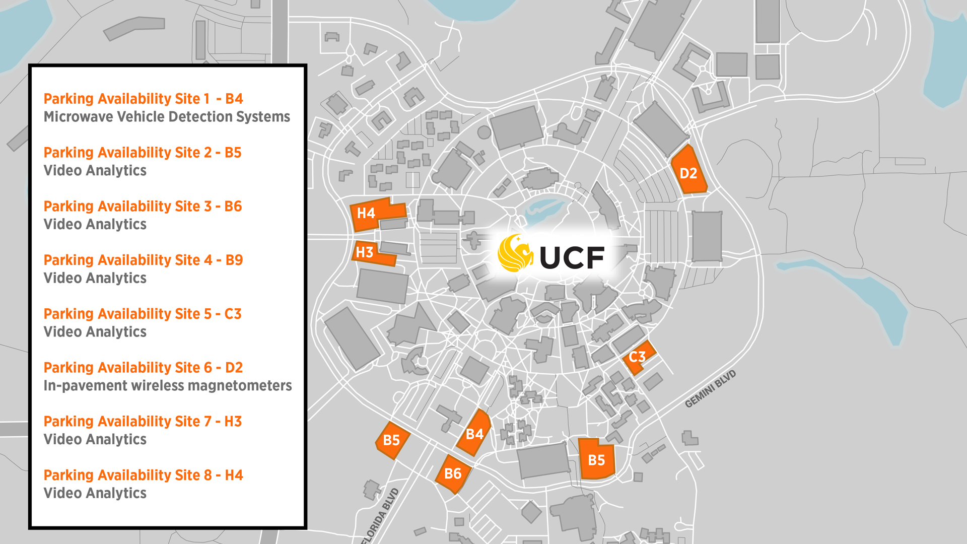
Surface Parking Management
The UCF Mobile app is undergoing a number of enhancements that are a part of improving transit for students. One feature will show real-time parking availability using sensors to communicate parking space availability to drivers. UCF parking garages will be added in the future. UCF also is working on using video recognition systems to identify empty parking spots. The parking management advancements will make it quicker and easier for students and employees to find a parking space.
SunStore
FDOT’s Data Storage and Research Sharing Initiative
SunStore is an ongoing initiative to connect and integrate the many data sources created and utilized by FDOT. It includes master data management, data fusion and sensor fusion for increased data quality. SunStore will make transportation data available to universities, research institutions, planners and businesses for research purposes. Data in SunStore will be used to support PedSafe, GreenWay and SmartCommunity deployments.